 Bukovel Tours
Home › Guides › What Is There to See in Ivano-Frankivsk on the Way to Bukovel?
What Is There to See in Ivano-Frankivsk on the Way to Bukovel?
Ivano-Frankivsk, a city of about 237,000 people, has Baroque churches, a town hall with a 33.3 m observation deck and three parks, and it sits 110 km from Bukovel. This guide covers what to see in a few hours, the opening hours, the road south and the official travel advice.
Quick answer Quick answer
Ivano-Frankivsk is a city of about 237,000 people with Baroque churches, a town hall with a 33.3 m observation deck and three parks, and it sits 110 km from Bukovel. It suits a stop of a few hours on the road to the mountains, once travel there is possible again.
Key takeaways
- The road from the city to the resort is 110 km via Nadvirna, Yaremche, Mykulychyn and Tatariv, so plan the Yaremche stop on the way.
- The Vorokhta trailhead for Ukraine's highest peak is 89 km from the city: see how to climb Hoverla.
- January in the city averages 0.8 C by day and -6.7 C at night, and the mountains are colder: see the wider Carpathian Mountains of Ukraine.
- After the transfer you need a bed: compare where to stay in Bukovel.
Is Ivano-Frankivsk Worth Visiting?
Yes, as a stop of a few hours before the mountains, because the Baroque centre, the town hall deck and the parks sit close together.
The city is the administrative centre of Ivano-Frankivsk Oblast in western Ukraine and the usual gateway to the Carpathian resorts. Tripadvisor lists Shevchenko City Park, Stometrivka, Tsunami Aquapark and Rynok square among the popular attractions.
What You Get for a Short Stop
The centre packs three kinds of sights into a small area. There are Baroque churches built between 1742 and 1763, two town halls on and around Market Square, and green space for the end of the walk. The old town hall on Market Square hosts an ethno-cultural museum. The modernist town hall, built 1928-1935, is the local history museum and carries the observation deck.
With an afternoon, start at Rynok square, climb the tower, visit the two main churches and finish in a park.
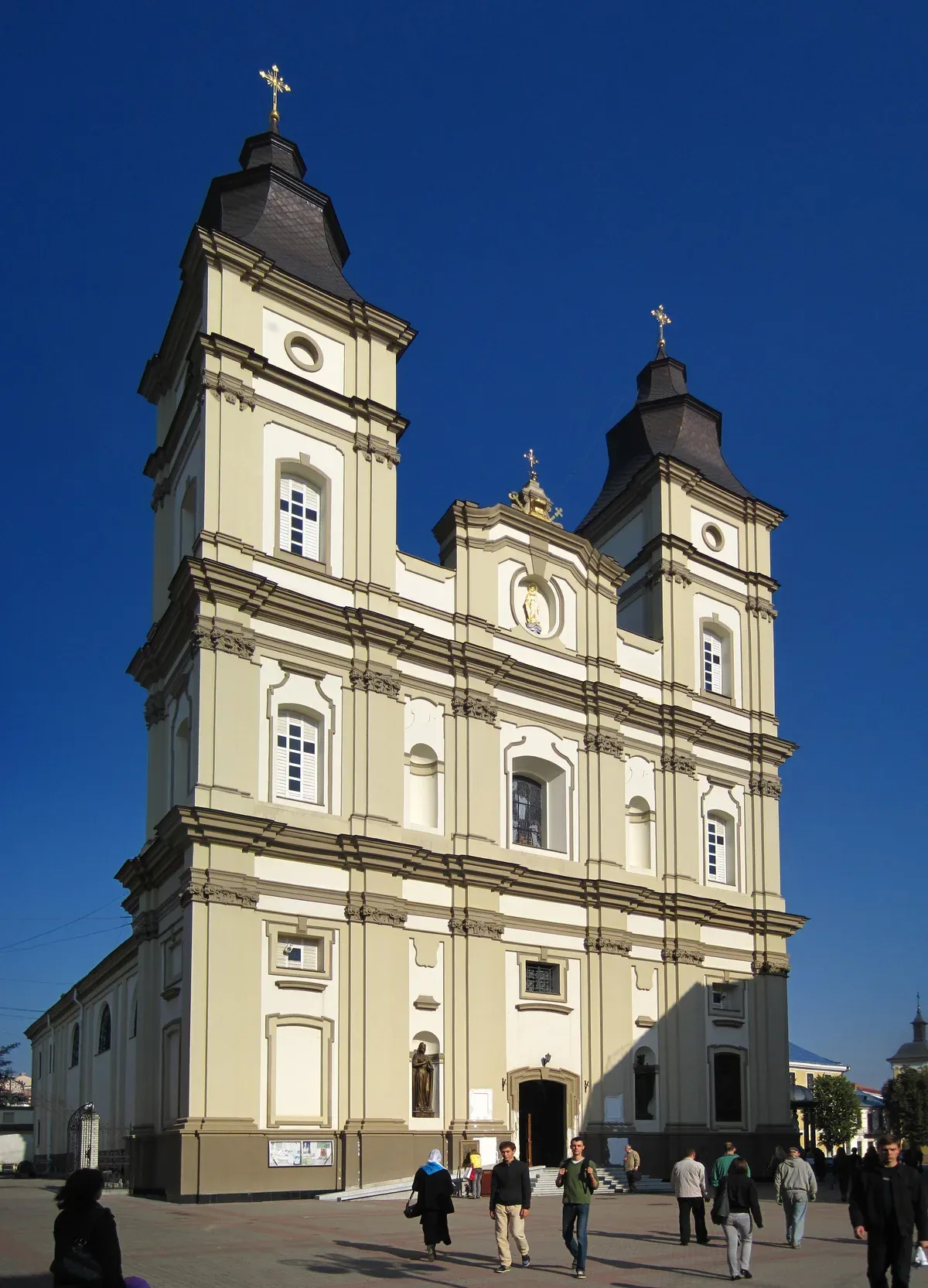
Cathedral towers in Ivano-Frankivsk. Photo: Vart ua, CC BY-SA 3.0, via Wikimedia Commons
Is Ivano-Frankivsk Safe?
The UK Foreign Office advises against all but essential travel to all parts of Ivano-Frankivsk region, and Canada advises against all travel to Ukraine.
Read the current status first: is Bukovel open tracks what is open and what the governments say.
What the Governments Say
The UK Foreign Office advises against all but essential travel to all parts of Ivano-Frankivsk region, together with Zakarpattia, Ternopil, Chernivtsi and Lviv. Canada's advisory reads Avoid all travel and has one level for the whole country, with no lower level for the west. Ukraine's airspace is closed, so the city's airport, which has had international status since 1992, is not a way in.
Travel insurance can be invalidated if you travel against FCDO advice. If you go despite it, buy cover that fits your itinerary, planned activities and emergency expenses.
What Changes Your Day
Russian missile and drone attacks can and do happen in the western regions. Be ready to take shelter at once when an air alert sounds, and install an alert app such as Air Alert. Know which curfews apply.
Attacks on the energy network cause blackouts and emergency power cuts that can affect heating and water. Follow train evacuation instructions, since attacks have damaged rail facilities. Consular help from the UK is very limited and cannot get you out of the country. Canada warns of robbery on trains, especially in overnight sleeper cars: lock the compartment door from inside.
Sources: UK Foreign Office, Government of Canada.
Where Is Ivano-Frankivsk Located Today?
It lies in western Ukraine on the Pokuttya Plain, along the Bystritsa River just above its confluence with the Dniester.
The city is the centre of Ivano-Frankivsk Oblast, which has six districts: Verkhovyna, Ivano-Frankivsk, Kalush, Kolomyia, Kosiv and Nadvirna.
Distances That Matter
The regional administration puts the city 716 km from Kyiv by rail and 614 km by road. The regional administration puts the city at about 237,000 residents.
Britannica notes that the city held an important position on the northern approach to the Yablonitsky Pass over the Carpathians. That is still its job: three national highways, H 18, H 09 and H 10, meet here and connect to E50, and the road to the resorts starts from the city.
| Question | Answer |
|---|---|
| Country and region | Ukraine, Ivano-Frankivsk Oblast |
| Population | 227,827 (2024 estimate) |
| By road from Kyiv | 614 km |
| By rail from Kyiv | 716 km |
| Highways | H 18, H 09, H 10 to E50 |
Was Ivano-Frankivsk Part of Poland?
It was founded as a Polish magnate's fortress in 1662 and named Stanislaviv, and Austria took it in 1772.
The old names tell the story: Stanyslaviv, Stanislav and Stanislawow, which is the Polish name you will see on old maps.
From Polish Fortress to Franko's Name
The magnate Andrzej Potocki founded the fortress town in 1662 and named it after his younger son. It received Magdeburg law the same year, and King Jan Kazimierz confirmed it in 1663. The French engineer Francois Corassini built a hexagonal fortress with bastions. Ukrainians and Poles lived in the north-east, Armenians in the south and Jews in the west.
Austria took the town in 1772 and held it until 1918. For about five months from November 1918 it was the capital of the West Ukrainian People's Republic, and the Act of Unification with the UPR was signed here in 1919. The city was renamed Ivano-Frankivsk in 1962 during its 300th anniversary, after the writer Ivan Franko. A monument to him went up on a central square in 1995.
What Can You See in Ivano-Frankivsk in a Few Hours?
Rynok square, the town hall tower, two Baroque churches and one park fit into an afternoon.
Everything below sits in the centre.
Rynok Square and the Town Hall
The market square was paved in 1695, the same year a stone town hall replaced the wooden one. Today's modernist town hall is 49.5 m tall. The observation deck sits beneath the dome at 33.3 m and takes 166 steps to reach.
Start here for the layout of the city, then walk down to the old town hall, now an ethno-cultural museum.
The Churches
The Armenian church, today the Pokrova cathedral, dates to 1742-1762. Inside are 14 large columns with figures and frescoes by Jan Solecki. The Greek Catholic Cathedral of the Holy Resurrection is the former Jesuit church, built 1753-1763, and its two tent-roofed towers borrow forms from Hutsul wooden architecture.
The Marian parish church, now the Art Museum, holds three crypts with Potocki burials. Its bell tower was destroyed in 1963 and rebuilt from old photographs in 2000.
Parks and the Station
Shevchenko Park has a lake with swans and an amusement park. Park Valy and Pryvokzalny Park are the other green stops. If you arrive by train, look at the station itself.
It was built in 1866 with Moorish elements and in 1897 became the first building in the city lit by electric lamps.
When Are the Town Hall Deck and the Museum Open?
The deck is open Tuesday to Sunday 10:00-19:00 with the last ascent at 18:30, and the museum is open daily except Monday 10:00-17:00.
Both are closed on Monday, so a Monday stop is for the outside of the buildings only.
Hours at a Glance
The table lists what is open and when. The Tourist Information Centre is in the town hall and gives free audio guides in five languages, and two audio routes called Mysterious Ivano-Frankivsk and Ivano-Frankivsk for Lovers. It also offers a guided visit to the town hall's underground rooms.
Its own opening hours vary between its pages, so confirm them at the door before you plan around it.
| Stop | Hours | Note |
|---|---|---|
| Town hall observation deck | Tue-Sun 10:00-19:00 | Last ascent 18:30, 166 steps |
| Local history museum (Ratusha) | 10:00-17:00, closed Mon | Ticket desk closes 16:30 |
| Tourist Information Centre | Confirm on arrival | Free audio guides in 5 languages |
How Do You Get from Ivano-Frankivsk to Bukovel?
The resort is 110 km from the city via Nadvirna, Yaremche, Mykulychyn and Tatariv.
From any Ukrainian city except Chernivtsi or Uzhhorod, you drive to Ivano-Frankivsk first, then turn into the mountains.
The Road in Stages
Bukovel sits in the village of Polianytsia between the Gorgany and Chornohora ranges. The Carpathian National Nature Park puts Yaremche 59 km from the city by road, about 2 hours. Yaremche and Vorokhta are the nearest stations on the Rakhiv rail line, and the park notes repairs between Krasnyk and Dzembronia. Check the timetable and the fare at the station before you fix the transfer.
The Ivano-Frankivsk region has two villages named Polianytsia, so set the sat-nav to the resort's coordinates, 48.353886, 24.412860. The Bukovel ski resort homepage has the resort itself, and Yaremche is the natural place to break the drive.
| Place | From Ivano-Frankivsk |
|---|---|
| Nadvirna | 35 km, about 41 min |
| Yaremche | 59 km, about 2 hours |
| Tatariv | about 78 km |
| Vorokhta | 89 km |
| Bukovel | 110 km |
Sources: Bukovel resort, Vorokhta council.
What Is the Winter Weather in Ivano-Frankivsk?
January averages a daytime high of 0.8 C and a night low of -6.7 C, with about 60 snowy days a year.
The city is milder than the resort, and the FCDO notes that temperatures in Ukraine may drop below -20°C in winter.
City Against Resort
Bukovel is colder and snowier than the plain. The table compares the two.
| January average | Ivano-Frankivsk | Bukovel |
|---|---|---|
| Daytime high | 0.8 C | -2.2°C |
| Night low | -6.7 C | -7.9°C |
| Snow | About 60 snowy days a year | About 29.1 cm |
Sources: Copernicus ERA5, UK Foreign Office.
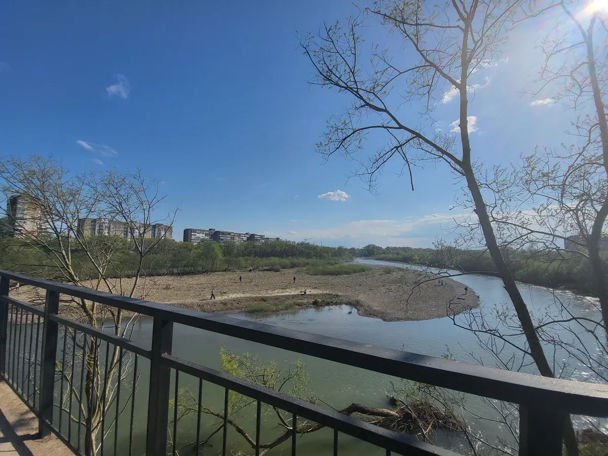
The river view in Ivano-Frankivsk. Photo: MgaydNiNE, CC BY-SA 4.0, via Wikimedia Commons
Ivano-Frankivsk FAQ
Is Ivano-Frankivsk worth visiting?
Yes, as a short stop on the way to the mountains. The Bukovel ski resort is 110 km away, and the stop covers the Baroque centre and the town hall deck.
Is Ivano-Frankivsk safe?
The UK advises against all but essential travel to the region, and the Carpathian Mountains of Ukraine guide repeats the advice for the wider area.
Where is Ivano-Frankivsk located today?
In western Ukraine on the Pokuttya Plain, 59 km by road from Yaremche.
Was Ivano-Frankivsk part of Poland?
It was founded by a Polish magnate in 1662 as Stanislaviv and passed to Austria in 1772. The Polish form is Stanislawow, and the road south leads to the Bukovel ski resort.
What is the population of Ivano-Frankivsk?
The regional administration puts it at about 237,000 residents. The wider mountains are in ski resorts in Ukraine.
Can you climb Hoverla from Ivano-Frankivsk?
The trailhead is near Vorokhta, 89 km from the city, and the hard 10.5 km trail takes about 5 hours, as the Hoverla guide explains.
More Guides
- What Is There to Do in Yaremche Near Bukovel?
What to do in Yaremche: Probiy waterfall, the 4 km Dovbush Trail and Dora. Plan a half day on your 2027 Carpathian trip.
- What Is There to See in the Carpathian Mountains of Ukraine?
Hoverla at 2,061 m, Yaremche, lakes and Bukovel skiing: what to see in the Carpathian Mountains of Ukraine. Plan your 2027 trip.
- How Do You Climb Hoverla, Ukraine's Highest Mountain?
How to climb Hoverla (2,061 m): blue and green paths, 3-3.5 h up, park rules and season. Plan your 2027 hike with this guide.