 Bukovel Tours
Home › Guides › What Is There to Hike in the Gorgany Mountains?
What Is There to Hike in the Gorgany Mountains?
The Gorgany are a wild range of about 80 km in the Ukrainian Carpathians, lying next to the Bukovel ski resort and topped by Syvulia at 1,836 m. This guide covers where the Gorgany are, which peaks, lakes and waterfalls to aim for, when to go and what the reserve allows.
Quick answer The short answer on Gorgany hikes
The Gorgany are a wild range of about 80 km in the Ukrainian Carpathians, with Syvulia at 1,836 m as the top peak. Only the eastern end has good road and rail links, so the realistic starts for a visitor from Bukovel are Vorokhta, Tatariv and Mykulychyn.
Key takeaways
- The Gorgany sit next to Bukovel ski resort, between the Gorgany and Chornohora ranges, but the trailheads are on the eastern side.
- For a first mountain day, the Hoverla climb from Vorokhta is easier to organise than a Gorgany traverse.
- Base yourself in Yaremche or Vorokhta for the railway and bus links to the eastern trailheads.
- For a wider choice of ranges, see the Carpathian Mountains of Ukraine.
Where Are the Gorgany Mountains and How Do You Get There?
The Gorgany stretch about 80 km, mostly in Ivano-Frankivsk region and partly in Zakarpattia, and only the eastern part has good road and rail links.
Maps split the range into Western, Central and Eastern Gorgany. The Bukovel resort in Polianytsia lies between the Gorgany and Chornohora ranges, so you can see the Gorgany ridges from the Bukovel area, but you start walking from other villages.
Borders and Size of the Range
The Mizunka River and the Vyshkiv Pass mark the western edge. The Prut River and the Yablunytsia Pass mark the eastern edge. Peaks mostly stand between 1,400 and 1,800 m, lower than the Chornohora ridge that holds Hoverla at 2,061 m.
Over 80% of the range is forest, mostly spruce. Above about 1,450 to 1,500 m the forest gives way to dwarf pine. The slopes also carry fields of sandstone debris, which locals call gorgan, grekhit or tsekota.
Starting Villages
Hikes begin from Myslivka, Osmoloda, Stara Huta, Bystrytsia, Tatariv, Mykulychyn and Vorokhta. Only the Eastern Gorgany have good road and rail connections. A railway through Tatariv crosses the range and links the Prut valley with Transcarpathia.
Vorokhta is 27 km from Yaremche and 89 km from Ivano-Frankivsk. Tatariv lies about 78 km from Ivano-Frankivsk. From Yaremche you can reach both by bus, and the Yaremche guide covers the town as a base.
| Start | Road and rail links |
|---|---|
| Vorokhta | Good |
| Tatariv | Good |
| Mykulychyn | Good |
| Bystrytsia | Weaker, western side |
| Osmoloda, Stara Huta, Myslivka | Weaker, western side |
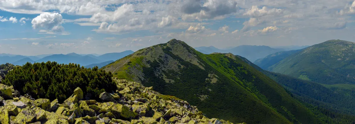
Velyka Syvulia seen from Mala Syvulia. Photo: Nata Mostova, CC BY-SA 4.0, via Wikimedia Commons
Which Gorgany Peaks Are Worth Hiking?
Syvulia at 1,836 m is the highest Gorgany peak, and eight more summits between 1,448 and 1,807 m line the ridge from west to east.
Nothing in the Gorgany reaches the 2,000 m mark.
Peaks from West to East
Use the table to place a peak on the ridge. Syvulia, Ihrovyshche and Vysoka top 1,800 m.
| Peak | Height |
|---|---|
| Gorgan Vyshkivskyi | 1,448 m |
| Grofa | 1,752 m |
| Popadia | 1,742 m |
| Syvulia | 1,836 m |
| Ihrovyshche | 1,807 m |
| Vysoka | 1,805 m |
| Doboshanka | 1,757 m |
| Syniak | 1,664 m |
| Khomyak | 1,544 m |
A Short History of Climbing Here
In 1897 a group made a ski ascent of Khomyak and Hoverla. Hoverla is not in the Gorgany. It stands on the Chornohora ridge, but its trail starts at Vorokhta, so many visitors combine the two.
The Hoverla guide has the day plan.
Source: Vorokhta Council.
Where Are the Lakes and Waterfalls in the Gorgany?
Synevyr is the easy and busy lake, Arshytsia and Rosokhan are hard to reach, and the waterfalls run fullest in June and July.
Water is the reason most day visitors come. Choose by effort, because the easy lake and the remote ones are very different trips.
Lakes by Difficulty
Synevyr is easy to reach and crowded. Arshytsia and Rosokhan are hard to reach. The park around Synevyr covers 430 sq km and has 13 hiking routes totalling 138 km,.
| Lake | Access |
|---|---|
| Synevyr | Easy and busy |
| Arshytsia | Hard to reach |
| Rosokhan | Hard to reach |
Waterfalls and the Best Month
The Manyavsky, Bukhtivetsky and Huk waterfalls are fuller in June and July. The Bukhtivets waterfall drops in valleys up to 1,000 m deep. The Huk waterfall near Tatariv, called Zhenets Huk, is about 15 m high and lies in the Carpathian National Nature Park, which makes it the easiest of the three to add to a Vorokhta or Tatariv stay.
Source: Vorokhta Council.
Which Gorgany Hikes Work from Vorokhta, Tatariv or Yaremche?
From the eastern villages you can do short walks as day trips, while the true Gorgany traverses take 3 to 6 days and a guide is the sensible call.
Short-stay visitors need to pick between a day outing and a traverse. The sample routes from one hiking operator show the scale of the multi-day option.
Day Outing or Multi-Day Traverse?
For one day, stay on the eastern edge near Tatariv and Vorokhta and take in a waterfall such as Huk. For a real Gorgany ridge walk you need several days and food and water planning.
The operator Kuluar Pohod lists three sample routes. Wild Paths of Gorgan runs 42 km over 4 days. The Manyavsky and Bukhtivets waterfalls with the Chortka ridge runs 28 km over 3 days. The Gorgan Stone slopes route runs 57 km over 6 days. Ask any operator for the current price before you plan.
| Route | Distance | Days |
|---|---|---|
| Wild Paths of Gorgan | 42 km | 4 |
| Manyavsky and Bukhtivets waterfalls with Chortka ridge | 28 km | 3 |
| Gorgan Stone slopes | 57 km | 6 |
Guide or Solo?
Deforestation can make some routes hard to pass, and water on traverse trails is scarce on the ridges. Gaps between water points are usually no more than 2 to 3 hours. Campsites often fit only 1 to 3 tents.
That is enough reason to go with a guide who knows the current state of the path. The Carpathian park also bans setting out on its routes without a qualified guide, so check the park's rules at the checkpoint.
When Is the Best Time to Hike the Gorgany?
August to October is the driest period, and frost is possible in May and October.
Pick your month by what you want to see. Waterfalls peak in early summer, while ridge walking is better in the dry months.
Season Guide
Summer lows at the parking lots rarely fall below +8 to +10 °C. Frost is possible in May and October, so a sleeping bag rated to about +5 °C is suggested for overnight trips. Waterfalls are fullest in June and July.
The nearest published figures are for Bukovel, which sits between the Gorgany and Chornohora. In July the average high there is 20.4 °C and the low 11.9 °C, with about 141 mm of rain over 19.6 rainy days. In August the rain falls to about 105 mm over 15.4 days. In September the high is 15.5 °C with about 92 mm of rain over 13.1 days.
| Month at Bukovel | Average high | Average low | Rainy days |
|---|---|---|---|
| June | 18.8 °C | 10.2 °C | 19.2 |
| July | 20.4 °C | 11.9 °C | 19.6 |
| August | 20.4 °C | 11.7 °C | 15.4 |
| September | 15.5 °C | 7.5 °C | 13.1 |
| October | 10.7 °C | 2.9 °C | 10.6 |
Source: Copernicus ERA5.
What Are the Risks in the Gorgany: Snakes, Bears and Dogs?
The viper is the only venomous snake, and shepherds' dogs and aggressive horses or bulls are more of a concern than bears.
The practical risks on the trail are small animals and weather. The war is a separate matter and rules the whole trip.
Wildlife and Ticks
Vipers hibernate from October to early May. Ticks matter mainly at 800 to 900 m. Bears are less of a worry than shepherds' dogs, so keep your distance from flocks and do not approach loose horses or bulls on high pastures.
Mobile coverage works only about a third to half of the time. Before you set out, notify the mountain rescue through the online form and save the local rescue contacts.
The War Comes First
The UK Foreign Office advises against all but essential travel to Ivano-Frankivsk region, and Canada advises against all travel to Ukraine. Airspace is closed. Missile and drone attacks can happen in the western regions, so be ready to take shelter when an air alert sounds.
Read is Bukovel open before any plan in the area.
Sources: UK Foreign Office, Government of Canada.
Can You Enter the Gorgany Nature Reserve?
The Gorgany Nature Reserve is a strict reserve of 5,344 ha, and mass recreation is prohibited, so only one booked trail is open to visitors.
Do not confuse the reserve with the wider range. It covers only a part of the Gorgany, so most of the hiking lies outside it.
What the Reserve Allows
The reserve was established in 1996 and ranges in altitude from 710 to 1,754 m in Nadvirna Raion. Mass recreation, construction, hunting and fishing are all prohibited. Old-growth forest covers 46% of the territory, and the reserve was founded to protect the relict Swiss stone pine.
The one visitor route is the Hrehoty Horhan science and education trail. It is 9 km, takes about 5 hours and opens only by advance booking with a reserve employee. The trail starts at the office of the Horhany research and conservation division. Its high point, Berezovachka, is at 1,080 m.
Getting There and the Rules
The reserve administration is in Nadvirna. From Nadvirna it is 35 km to Ivano-Frankivsk, 26 km to Chernyk and 30 km to Bystrytsia. Buses run from Nadvirna to Ivano-Frankivsk, Lviv and Uzhhorod and on to Bystrytsia, Zelena and Chernyk. Roadworks slow the Chernyk and Bystrytsia stretch.
Stay on the marked route. Picking plants, cutting trees, hunting, fishing, smoking in forest and litter are banned. Fires are allowed only in designated places.
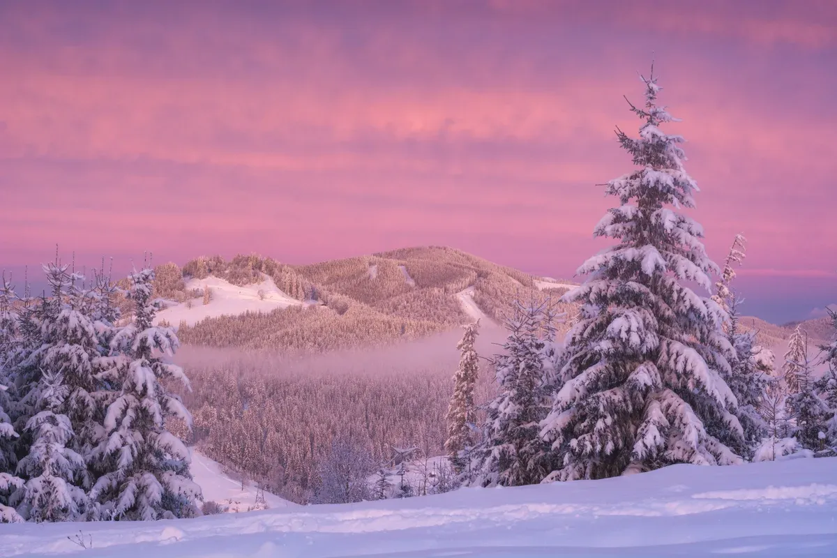
A winter dawn in the Gorgany. Photo: Vitalii Bashkatov, CC BY-SA 4.0, via Wikimedia Commons
Gorgany Questions Answered
What Is the Gorgany Race?
The Gorgany Race is a yearly 30-hour adventure race held in the range. Check the organisers for the current edition. The Bukovel ski resort page shows where the range sits relative to the resort.
What Does Gorgany Mean in English?
Gorgany is the Ukrainian name of the range, and English texts use the same word. The name also belongs to an outdoor clothing and camping brand, which is why a shop tops the search results. For the mountains, see the Carpathian Mountains of Ukraine.
How Far Is the Gorgany from Bukovel?
Bukovel sits in Polianytsia between the Gorgany and Chornohora ranges, so the range is in view, but the trailheads are in villages such as Vorokhta and Tatariv. Start with the Bukovel ski resort page and then pick a trailhead.
Is the Gorgany Higher Than Hoverla?
No. The highest Gorgany peak, Syvulia, is 1,836 m, while Hoverla reaches 2,061 m. Read the Hoverla guide for that climb.
Where Can You Stay Near the Gorgany?
Yaremche and Vorokhta are the practical bases for the eastern trailheads. For beds near the resort, see Bukovel hotels.
More Guides
- How Do You Climb Hoverla, Ukraine's Highest Mountain?
How to climb Hoverla (2,061 m): blue and green paths, 3-3.5 h up, park rules and season. Plan your 2027 hike with this guide.
- What Is There to See in the Carpathian Mountains of Ukraine?
Hoverla at 2,061 m, Yaremche, lakes and Bukovel skiing: what to see in the Carpathian Mountains of Ukraine. Plan your 2027 trip.
- What Is There to Do in Yaremche Near Bukovel?
What to do in Yaremche: Probiy waterfall, the 4 km Dovbush Trail and Dora. Plan a half day on your 2027 Carpathian trip.